I like to visit Cameron Highlands. Travelling there almost every year, sometimes it is good to visit other highlands and other places. Each highland has its own charm and activities. In the case of Bukit Fraser, it is a smaller highland in comparison with Cameron Highlands or Genting Highlands.
You might call it the smaller cousin of Cameron Highlands as it hasn’t got so many things to do, but nevertheless still have its own charm. Though it doesn’t has the extensive farms and tea plantation it does have the tranquillity of an English countryside with its colonial bungalows, lush greenery and fresh cool air.
Fraser’s Hill is named after Louis James Fraser, a Scotsman who made his fortune from tin mines when he discovered the availability in the vicinity of Bukit Fraser.
The Scotsman has a colourful past; he tried to increase his profits by setting up gambling dens and opium house which could have contributed to his mysterious disappearance.
Nevertheless, the valleys and the hills was named after him, and was revived as a hill resort for the British who wish to have a cool respite from the unending heat of the tropics.
A road was constructed in 1922 which helped some progress of Fraser’s Hill. With the easier access, bungalows were constructed and even one of the first golf courses in Malaysia was build.
Pretty nothing much has changed since the last many years and not much development could be seen about Fraser’s Hill. There was some mention in the dailies about further development of Bukit Fraser to bring in more tourists; this will remain to be seen.
Fraser’s Hill is really a very quiet place. Much more quiet than Cameron Highlands. If doing nothing and just pure relaxation is your cup of tea, this is definitely the place for you to take a break. No farms and markets to buy your vegetables, no tea plantation to visit, no bee apiaries, giant nurseries, etc.
This place is just pure relaxation. You could though still go for jungle nature walks, book a round at the greens and tee off if you are a golf enthusiast, jog around the place, or play tennis in the tennis courts. There are still a few places to go if you really need to do something. However, most people find Fraser’s Hill too quiet for their taste. But hey, a getaway is supposed to be relaxing, ain’t it?
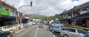
Driving up can be tricky
At 1524 m elevation, the highland is really cool and mist comes by quite often obscuring the view. The moist cotton like covering makes one feel like you are in the ‘heavenlies’ though it makes driving around a bit dangerous. Switch on your car headlights, and honk often!
Bukit Fraser is a favourite place for bird watching. It is famed worldwide as a bird watching destination. It seems it has about 250 species of birds. Bird watching is not for me though, walking noisily about; I guess the bird would have thought of me as a bull in a china shop, keeping an eye on me just in case I become like cat on the prowl looking for bird meal.
I’ll leave it to the bird watchers to spot the flying friends; I can’t imagine sitting quietly with a pair of binoculars in hand and bird guidebook trying to figure out what kind of bird I am looking at.
Nah, I’ll be happy to see that the birds and animals if I ever do spot any and would really be glad that they are thriving from the lack of development of Fraser’s Hill. It seems a good bird watcher could easily spot 70 species within 24 hours! Nope, spotting birds is not my hobby. Going for holiday travel and blogging on my Cameron-Highlands-Destination.com website is my hobby. Yeah!
At one time, Fraser’s Hill was the preferred highland destination rather than Cameron Highlands, as it was closer to Kuala Lumpur, and there was no NKVE expressway for a speedy drive to Cameron Highlands.
However with the over development of Cameron Highlands, there is now heavy congestion during the peak period during school term holiday breaks especially when it coincide with public holidays and Singapore school term breaks as well. The results? A traffic jam nightmare.
In some cases, some accommodation also experience water shortages as the public water supply department could not cope with the increase of tourist arrival. Trying to get away from the maddening crowd and end up in another one? Perhaps, Fraser’s Hill will look poise as an alternative highland destination. Only time will tell whether it will be so.
Getting to the Hill
There are several ways to get to Fraser’s Hill. It takes approximately 2 hours drive from Kuala Lumpur using a combination of North-South Expressway and the old trunk road from Kuala Lumpur to Ipoh.
If you are coming from the south using the North-South Expressway like from Kuala Lumpur, my suggestion is to use the Rawang exit, and proceed using the old trunk road and head for Kuala Kubu Bahru town. I feel this is nearer than heading all the way to Bukit Beruntung and exiting from there.
If from the north, the choice would be from Bukit Beruntung and follow the signboard looking out for Kuala Kubu Bahru town or Fraser’s Hill.
Once you hit Kuala Kubu Bahru, just follow the signage to Fraser’s Hill. Initially the road is a little narrow parallel to a river fame for white water rafting outdoor adventure enthusiast. As you go along and reach the Selangor Dam the road open up wide and with its gentle curves makes for an easy drive.
The Selangor Dam was completed in April 2003, able to hold up to 235 million cubic meter of water. With its 6 square kilometers of beautiful picturesque view, I couldn’t help but stop along the way to have a look at the magnificent scenery.
I’m sure many of you would stop too, because I was not the only one taking a breather along the way as I saw many passing cars pulling along the road shoulder and the occupants getting off to admire the view. Once you passed the Selangor Dam, the road narrows and becomes winding again.
And if you are coming from the east coast, like from Kuantan, you have to head to the direction of Bentong than to Raub. The route from Bentong to Raub is quite easy to drive as the road has been upgraded. It is quite straight and many cars zoom at quite a face pace.
Though it may be straight, it does go up and down like a sea wave. Somewhere along the way before reaching Raub there will be a turning heading to Fraser’s Hill. There are several branches along the route heading to Raub which you can turn into to head up to the hills. The signages are marked clearly so you can’t make a mistake. Just take any that comes along your way, in the end they end up on the same winding road leading to the Gap.
The Gap and gate control if any
Once you reached the Gap, you can take a break at the Gap Resthouse, or if you just can’t wait to go to Fraser’s Hill, then proceed the remaining 12km by using the new road if it is accessible.
With the new road there is no need to follow the regulated traffic flow for traveling to and fro from the Gap to Fraser’s Hill. Just head directly to the new route up and you will be in Fraser’s Hill in no time. The new road will exit near to the Fraser’s Pines Resort Hotel.
If for some reason, perhaps landslides or something, the authorities may have to close the new road. Then depending on your arrival timing you may have to hang around the Gap, perhaps drop in to the Gap Resthouse, have a meal, or just stretch your legs awhile. If the regulated traffic is in force, just remember the timing as: the going up period is the odd numbered hours, while the returning traffic is in the even numbered hours.
Those were the days when a long queue of cars and vehicles has to wait for the gate to open to allow the traffic to proceed on its journey. Most people will just mill around chit chatting to pass the time as there was nothing else much to do.
And when the sun sets, there is no more regulated traffic control between 8pm to 7am, in which case driving around this time and in the dark is quite risky. So better drive there while there is plenty of daylight!
Public Bus Transportation
And finally, if you are an backpacker adventurer and somehow manage to find your way to Kuala Kubu Bahru,(KKB) there is a public bus service which you could use for your jouney to Fraser’s Hill.
Ask around the locals for the Kuala Kubu Bahru bus terminal. The bus schedule departing times as provided (don’t know how accurate is this, so use this at your own risk):
- KKB to Fraser’s Hill – 8am and 2pm
- Fraser’s Hill to KKB – 10am and 4pm
Getting Around and Maps
The choice method of getting around Fraser’s Hill (Bukit Fraser) is none other than by car. They do not have any public transport system unlike Cameron Highlands.
I have not come across any taxi or public buses while visiting Bukit Fraser. If you do not have your own transport and feel you are very fit or need a good dose of hillside exercise, than be prepared to walk a lot.
Though Fraser’s Hill may not be as big as Cameron Highlands, moving around on foot is not so easy. However I did see very determined tourists who actually walked from one place to another.
There are no maps sold in the Fraser’s Hill, though you could get a free map from the hotel that you are staying or pop in to the Tourist Information Centre located at Puncak Inn.
You could also get a map in advance from a bookstore before going up to Fraser’s Hill.
Usually the map booklet has the main map of Cameron Highlands and the Fraser’s Hill combined with it on another page, perhaps together with a map of Taiping in one booklet depending on which version that you could lay your hands on.
The layout of Fraser’s Hill is fairly simple. The town centre is where the famous clock tower is located where it is one of the most often photographed icon of Bukit Fraser. Around it is the Post Office and Police station, Puncak Inn with the simple row of shops which include the Tourism Center and next to it the Golf Course.
The main route that circles around Fraser Hill will skirt around the golf course, goes past a bungalow called Bishop’s House, comes down pass a children’s playground, passing by the Fraser’s Hill Development Corporation before ending back up at the clock tower again.
There are many bungalows spread out around Fraser’s with many open to the public for an interesting colonial style accommodation. You could of course opt for normal accommodation by staying at Silverpark Apartments, Fraser Pine Resort or Jelai Resort.
Jungle trails are plentiful, most are short and easy to trek, though some precaution is still needed as some people has strayed from the path and got themselves lost in the jungle before.
Anyway, you could try printing the snapshot of the map that I got from the tourism office. It may not be very clear but at least it is something for your reference. Just click at the picture above or the link below to view the bigger map.
Bukit Fraser (Fraser’s Hill) Hotels, Apartments, Bungalows and Accommodations
Fraser’s Hill being a smaller highland in comparison with Cameron’s has less choice for hotels and accommodations. Still you could find some suitable choice.
One interesting thing about Bukit Fraser is that they have lots of bungalows available to the public. Some of the bungalows are managed by Government run Fraser’s Hill Development Corporation. The bungalows are rather old, but do provide an interesting ambience to the accommodation. If you rather prefer somewhat modern accommodations you could try the apartments like Silverpark.
On a peak period, many of the accommodation do get fully booked just like those in Cameron Highlands. So do book early to avoid any disappointment.
The listing below is what I have in hand at the moment. I will list additionally when more information becomes available. And please don’t ask me for their email contacts, like most accommodation in Cameron Highlands, they are not that sophisticated to have communication using the internet.
Hotels and accommodations list
- Puncak Inn – Tel: 09-362 201
- FHDC Banglo / Apartment – Tel: 09-362 2201 / 362 2195
- Fraser’s Pine Resort – Tel: 09-362 2122
- Fraser’s Hill Resort – Tel: 09-2697 9772
- Jelai Highland Resort – Tel: 09-362 2600
- Shahzan Inn – Tel: 09-362 2300
- Silver Park Holiday – Tel: 09-362 2888
- Sri Peninjau Apartment – Tel: 09-362 2226
- Rezab Mutiara (Banglo) – Tel: 09-2164 4191
Bukit Fraser (Fraser’s Hill) Sights and Attractions
Though Bukit Fraser’s Hill may be smaller than its sister Cameron Highlands, and of course Fraser’s Hill is a lot less quiet, one could still find something to do. Let’s see if we can dig up some interesting sights and attraction for good old English colonial charm highland.
I’m going to give a quick list here and write up some info for each item when time permit. And hopefully scrounge up enough information for your quest for knowledge.
Here we go:
- Golf course and sports complex in the town centre
- Jungle walking and trekking – do be careful here
- Children Playground – this is definitely for the kids
- Allan’s Water – for some family boating fun
- Jeriau Waterfall – for a cold splashing time
- Bird Watching – definitely for the birds
- Pony Rides – hee har!
- Archery – and bring out the Robin Hood in you
Looking for more? As I said this place is really peaceful. No tea plantation, no flower nursery (unless you consider the one next to Allan’s Water), no farms. Just peace and quiet.
Bukit Fraser’s Hill Interesting Quick Facts
Here’s some interesting bits of trivia about Fraser’s Hill (Bukit Fraser). Though this may be a small highland escapade in comparison with Cameron Highlands, it still not without its charm and bits of intriguing facts.
When I brought my family and friends around I could fill them in with bits of interesting story of the various places.
The amount of information that I knew was so much until they thought my other job was as a travel guide! Well, more like a travel writer for good old Cameron-Highland-Destination.com web site.
Anyway, here are the bits of information. So after reading them you could boast around a bit and perhaps people might think you are a travel agent or something!
- Though I may not be an avid golfer, did you know that the Fraser’s Hill town golf course is the first highland golf course and the second in Peninsular Malaysia? The first golf course was located in Taiping.
- Here’s an interesting fact, the Fraser’s Hill golf course was built on a former tin mine. Hmm… may have something to do with Louis James Fraser, then again maybe not.
- I’m sure if you visit Fraser’s Hill, this is one photo you must take. The Fraser’s Hill clock tower in the town square is the most photographed object. Just about every time I drop by Bukit Fraser, I will snap a picture of this clock tower. No dispute about this comment.
- The Abu Suradi Trail is named after Abu Bin Suradi, the first Malay to operate a tin mine at Bukit Fraser in the late 19th century. His mine was located at the present ninth fairway of the town golf course.
- For the WWII enthusiast, here’s an interesting trivia. The first buildings in Bukit Fraser were named after the ‘pillboxes’ (you know, especially C&C; gamers should know, those little bunker with machine guns used for defences during the World Wars) because of their knobbly and formidable fortress like appearances. They are the Polygon-Mogador and Ledegham (which was demolished to make way for Silverpark Holiday Apartments) and Hollebekke overlooking the town centre.
- Bukit Fraser has an elevation of 1524 meters above sea level. Just below the elevation of Equatorial Cameron Highlands which is around 1628 meters highest point of the main road. The highest point in Cameron Highlands is 2032 meters located at Gunung Brinchang.
- Bukit Fraser area is comprised of seven hills. For those who like counting, you could hop around the place and see whether this fact is true. Though personally I’m not too sure how to spot the seven peaks that represent the seven hills in Fraser’s Hill.
- The average climate temperature of Fraser’s Hill is between 21 to 23 degrees Centigrade. Cool enough to escape from the heat of the tropics though you would still feel warm when the noon day sun is beating down on you.